William Dargue A History of BIRMINGHAM Places & Placenames from A to Y
Peddimore
B76 - Grid reference SP153936
Pedimor: first record 1298
This settlement was on 'Pede's marshland', a named derived from Old English Peoda's (a personal name pronounced Pedder) mor.
However, this is a site of much more ancient habitation. In a field west of the hall a neolithic flint and a flint scraper were found, evidence of people living here over 5000 years ago. A Roman coin was also found close to the hall itself. And extensive ridge and furrow possibly dating from late Anglo-Saxon period remains visible both west and east of Peddimore Hall, because the site has remained in continuous agricultural use since that time.
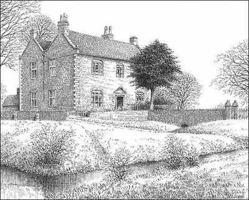
Take a look. Peddimore Hall as seen is a 17th-century hall built in brick with sandstone dressings by William Wilson from 1660-1671 for William Wood, Warden of Sutton Corporation. The hall's history certainly goes back to the 13th century, but it must have fallen out of use sometime before the 17th century. The antiquarian William Dugdale visited the site in 1656, and noted that nothing remained but a large moat.
The present house therefore stands on a 13th-century site and is surrounded by a medieval double rectangular moat whose remains can be seen. A chapel here was licensed in 1360. The timber-framed barn dates from 1385.
The manor of Peddimore is first documented with Curdworth c1281 in the hands of the de Arden family from the Earls of Warwick. One of the latter, William de Beauchamp gave Thomas de Arden and his
heirs rights of piscary, ie. fishing, in Plantsbrook adjacent to his lands, rights of pannage, ie. allowing pigs to eat acorns and beechmast, on Sutton Chase, the right to take timber from the
Chase to repair buildings within the manors and also the right to sell twenty pounds' worth of timber. Peddimore descended with Curdworth in the Arden family until the beginning of the 17th
century.
A cousin of the Arden family was William Shakespeare, who may well have visited the original house. Sutton Coldfield is mentioned by Falstaff in Henry VI Part 1 Act 4 Scene 2 where Henry's
friend, Sir John Falstaff is on the road near Coventry raising an army to support the king against rebel barons:
Bardolph, get thee before to Coventry; fill me a bottle of sack; our soldiers shall march through; we'll to Sutton-Cophill tonight.
Samuel Lewis's 1848 Topographical Dictionary of England described Peddimore Hall as lying
'in a retired valley below Langley heath, and . . . standing in a lonely and unfrequented district which formed part of the forest of Arden.'
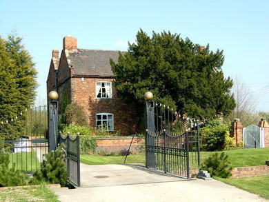
This private house, a Grade II Listed building and Scheduled Ancient Monument, may be seen from a public footpath off Peddimore Lane which passes nearby.
William Dargue 04.04.2009
For 19th-century Ordnance Survey maps of Birmingham go to British History Online.
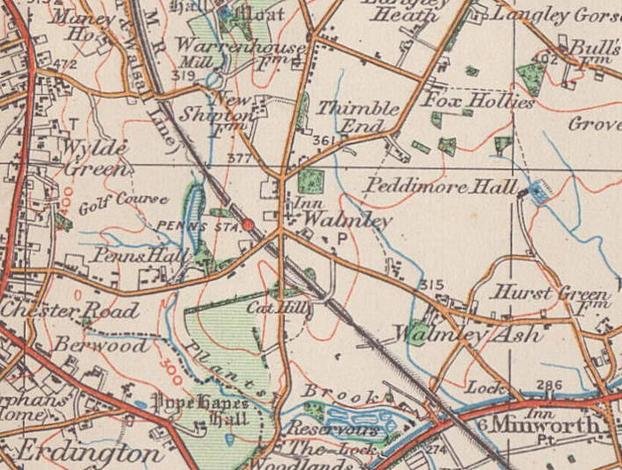
Map below reproduced from Andrew Rowbottom’s website of Old Ordnance Survey maps Popular Edition, Birmingham 1921. Click the map to link to that website.