

William Dargue A History of BIRMINGHAM Places & Placenames from A to Y
Minworth
formerly in Warwickshire - one of the Domesday manors of Birmingham
Minworth Greave/s, Minworth Green, Minworth Bull Ring
B76 - Grid reference SP157923
Meneworde: first record in the Domesday Book 1086
When excavations were undertaken for Minworth sewage works, evidence of the Pleistocene period was found here, including the fossilised bones of a mammoth which walked this way one million years ago.
The name of the settlement was documented at Domesday as Meneworde from the Old English Mynna's worth, 'Mynna's farmstead'. Although Mynna is not found recorded elsewhere as a
personal name, it is believed to be such. At this time Minworth was a small and poor manor of only one hide, c50 hectares. There was sufficient land for one ploughteam, but land only
equivalent to half a ploughteam was under cultivation worked by a single villein. The manor had 5 acres of meadow presumably along the north bank of the River Tame and a small amount of woodland,
half a league long by three furlongs wide.

Before the Norman Conquest an Anglo-Saxon, Godric had held the manor from Thorkell, Lord of Warwick, and he continued to hold it thereafter. This was unusual: Norman lords were in control of most of the Birmingham manors by 1086. In the time of King Edward the value for tax purposes was five shillings, a small amount, and this was till the case in 1086.
Minworth Mill on the River Tame ground corn here from at least the 14th century until 1872. By the middle of the 18th century the mill was also taking advantage of Birmingham's successful
armaments trade and was engaged in boring gun barrels. All traces of the mill are now gone, obliterated by a late 20th-century industrial estate which stands on the site half a mile west of Water
Orton Bridge. However, traces of watercourses are still visible.

Minworth sewage treatment works
Minworth is well known for its huge sewage treatment works to the east of the village. This dates from c1900 when the very extensive and expanding sewage farms along the River Tame in Birmingham were abandoned as conversion to bacterial filtration took place at Nechells and at Minworth. Although this needed far less space, the works here expanded rapidly as the population grew.
Now all of Birmingham's sewage and much of the sewage of the Black Country is gravity-fed to the works, with the exception of sewage from neighbouring Curdworth which has to be pumped uphill to the works. Extensive tree screening surrounds this very large site.
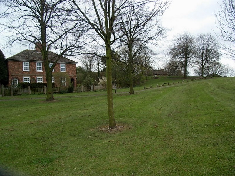
Minworth Green
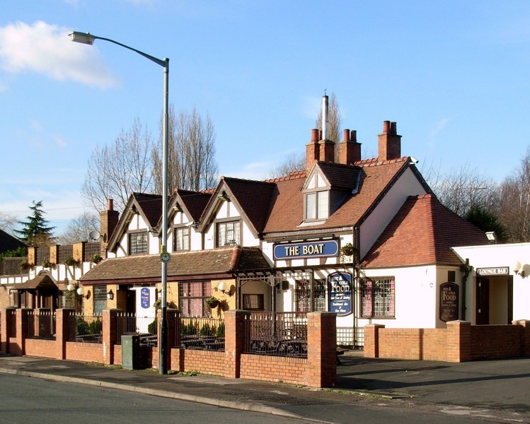
This was a traditional rural village community in 1891. The Census records some 20 houses clustered around the village green whose occupants carried out a range of agricultural activities or were in various type of service: servant, groom, gardener, laundress, etc. In addition there was Arthur Bryant, the publican of the Hare & Hounds Inn, there were two schoolteachers, a postmistress, a baker and a grocer. Mary Ann Hughes aged 74 ran the blacksmith's, while 90-year-old Ann Cater lived here ‘on her own means'.
Minworth Bull Ring
The 1891 Census records a rural hamlet of seven households at the Bull Ring. It is not clear where this was, but it may have been at the junction of Water Orton Lane and Park Lane where the 1890 Ordnance Survey map shows a hamlet of some half dozen cottages. The heads of households were mainly agricultural labourers with a boot and shoe maker and his son.

The manor of Minworth lay within the ancient parish of Curdworth in Warwickshire until 1931 when its west part was amalgamated with Birmingham. The remainder came into the City with Sutton Coldfield in 1974.
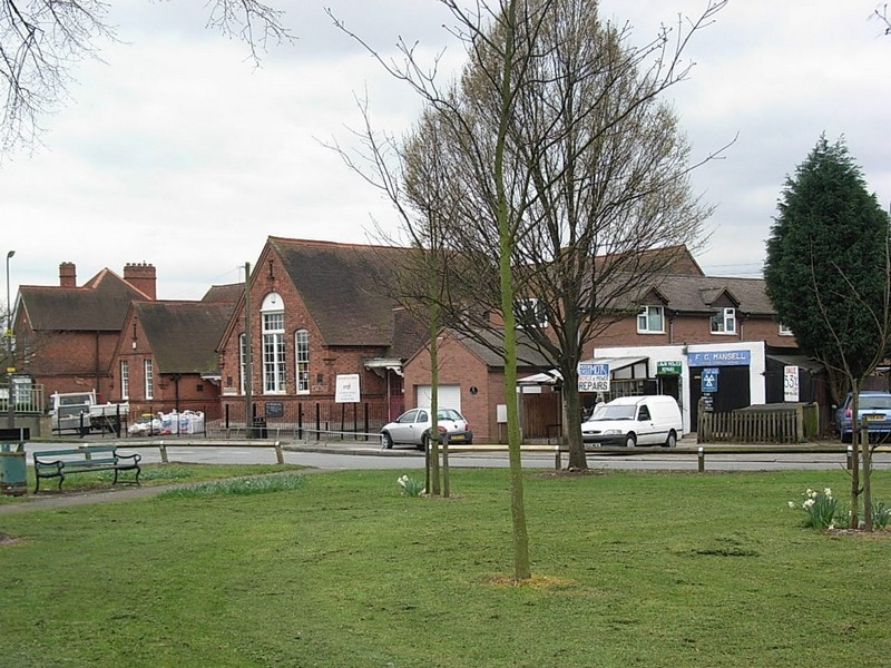
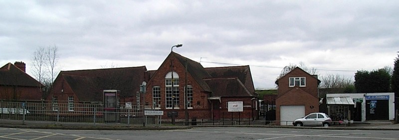
Centred at the north end of Water Orton Lane at its junction with the Kingsbury Road, Minworth still retains its identity as a village despite its close proximity to the east end of Castle Vale estate. Many of the houses here were built to house the employees of the sewage works.
The church of St George
The small church of St George the Martyr opened in 1909. Minworth had previously been in the parish of neighbouring Curdworth. St George's is now part of the parish of Castle Vale with Minworth.
Minworth Greave/s
The name of nearby Minworth Greaves may derive from a surname, or from the Old English/ Middle English word graefe meaning 'brushwood' or 'scrubland'. This farming hamlet lay just east of Minworth on the Kingsbury Road west of Water Orton Lane.
The 1841 Census records the hamlet as Graves and lists nine families of agricultural labourers, one boat builder, John Jefferies, presumably working alongside the Birmingham & Fazeley canal, and a cordwainer. The latter was a shoe-maker and mender; many small hamlets could usually boast a cordwainer and his son following in his father's footsteps.
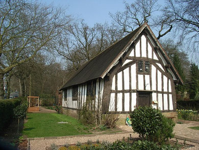
Pay a visit to Minworth Greaves at Bournville.
This 14th-century cruck-framed cottage stood originally here but was dismantled and re-erected in Maple Road, Bournville in 1932. Its exact original location is now unknown. By the late 19th
century it was being rented as two dwellings and was in poor condition. Sometime after 1880 it was decided to strip out the house and sell anything worth recycling leaving nothing but the
framework of timbers. In 1911 George and Laurence Cadbury bought the frame, had it dismantled to be rebuilt on Bournville Green. It was not in fact rebuilt until the 1930s when it opened as a
public museum owned by the Bournville Village Trust. It is a Grade II Listed building.
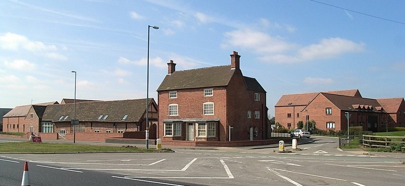
Still in situ is Minworth Greaves Farm on the north side of the Kingsbury Road. This large 3-storey Georgian farmhouse was built in the late 18th century. With its extensive
outbuildings it was converted in 2001 into separate dwellings. During the building work an archaeological watching brief revealed a number of 13th- and 14th-century features. These included ditch
boundaries, a gully, a post hole and a rubbish pit. However, no evidence of contemporary buildings was found. Later buildings had probably been built on the earlier site. The evidence suggests
that the hamlet dates from c1300. The 13th-century ditch fill contained 16th-century pottery, confirming occupation at this time. A 15th-century timber-framed barn survives.


William Dargue 06.04.2009/ 10.09.2012
For 19th-century Ordnance Survey maps of Birmingham go to British History Online.
http://www.british-history.ac.uk/mapsheet.aspx?compid=55141&sheetid=8819&zm=2&x=9&y=0&ox=325&oy=216
Map below reproduced from Andrew Rowbottom’s website of Old Ordnance Survey maps Popular Edition, Birmingham 1921. Click the map to link to that website.
