William Dargue A History of BIRMINGHAM Places & Placenames from A to Y
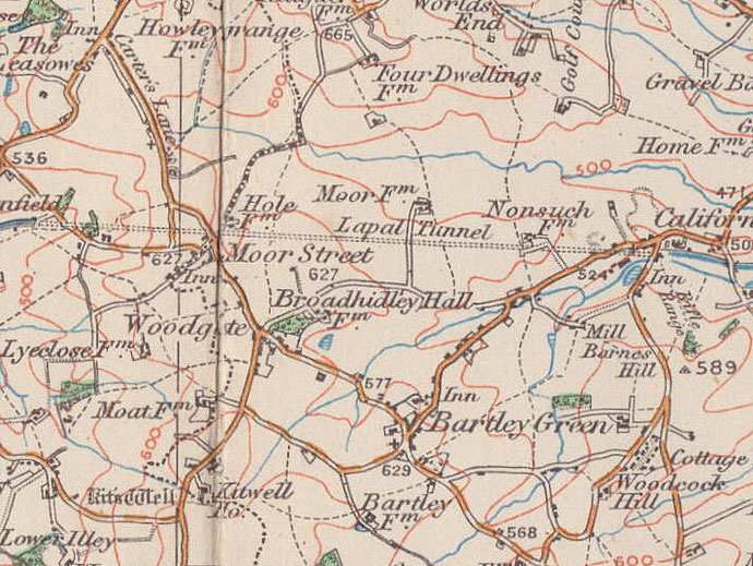
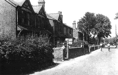
Moor Street
B32 - Grid reference SO991829
de la More: first record 1275
It is not unusual to have what is apparently a street-name as a placename, but it can be confusing. Even more confusing when there is no street here called Moor Street. This is a locality at the south-west end of Woodgate Valley Country Park. It lies around the junction of Clapgate Lane and Woodgate Lane.
Moor Street was only ever a hamlet, and by 1840 a row of cottages stood here. It was not until after the Second World War that this area was built up as part of the housing developments around Bartley Green.
A moor was the medieval term for a marshy boggy area - the Bourn Brook is close by.
William Dargue 07.04.2009/ 26.07.2015
For 19th-century Ordnance Survey maps of Birmingham go to British History Online.
Map below reproduced from Andrew Rowbottom’s website of Old Ordnance Survey maps Popular Edition, Birmingham 1921. Click the map to link to that website.