Tinkers Farm, Northfield
B31 - Grid reference SP013793
le Tynekare: first record 1275
Tinker was the name of a family who were recorded here in 1275. (Upper) Tinkers Farm was of medieval origin and stood east of Tinkers Farm Road, probably within a moat.
Around 1930 a great swathe of land west of Northfield was developed for municipal housing as the City Centre slums were demolished. The Tinkers Farm estate was part the Allens Cross development which was built on the farmland of Upper Tinkers Farm, Lower Tinkers Farm and Allens Cross Farm to house over 6000
people.
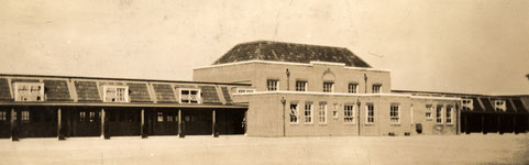
Tinkers Farm Primary School on Tinkers Farm Rd, which opened in 1930, was built on the site of the ancient farm. Temporary huts were used for the first pupils to enrol and were gradually supplemented and then replaced by permanent buildings over the next two or three years. Senior departments were opened in 1932 becoming separate boys' and girls' schools in 1945.
The primary school closed in 1957 and the secondary schools took over their buildings. The secondary schools closed in 1969 when Northfield Comprehensive School opened, the buildings were later demolished and the site has been redeveloped for housing.
William Dargue 04.04.09/ 26.07.2015
For 19th-century Ordnance Survey maps of Birmingham go to British History Online.
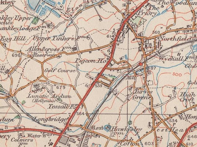
Map below reproduced from Andrew Rowbottom’s website of Old Ordnance Survey maps Popular Edition, Birmingham 1921. Click the map to link to that website.