William Dargue A History of BIRMINGHAM Places & Placenames from A to Y
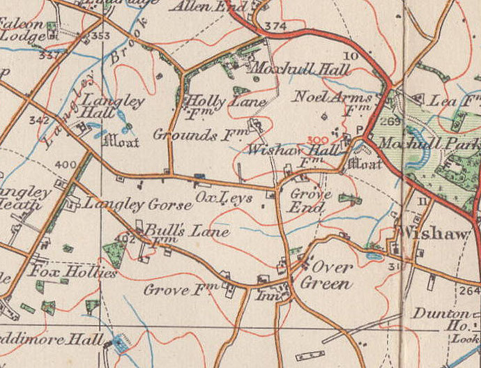
Grove End
B76 - Grid reference SP166950
At the junction of Grove Lane and Ox Leys Road, Grove End is set in countryside to the east of Sutton Coldfield. An important medieval survival here is a substantial house which was probably built in the early 14th century. The Grove is cruck-framed building which was extended and rebuilt around the timber frame in the 17th century and further altered and extended in the 19th century. The exterior is in brick and the crucks are visible only inside where the medieval four-bay hall is preserved. Timber framing can be seen on the elevation along Ox Leys Road. This Grade II* Listed private house, one of the oldest in the Birmingham area, is unfortunately visible only by peering over a wall which has been raised by several courses presumably to prevent people peering over.
Roman fields
Between Bulls Lane and Ox Leys Road can be seen banks and hedges which mark out square fields. This distinctive pattern suggests Roman or even pre-Roman fields. The field boundaries are clearly shown on the Sutton Coldfield Corn Rent map of 1825 which is held in Sutton Library. The fields can be seen extending for some 2 km in a north-south direction. Indeed, the routes of some local roads seem to respect these field boundaries and may therefore also be of Roman date. The fields system would have been abandoned after the Roman withdrawal but with population growth would have been taken back into use by the 14th century. This is believed to be the oldest evidence of a field system or indeed of any agriculture in Birmingham.
See also Bumble End.
William Dargue 15.12.2008/ 24.10.2012
For 19th-century Ordnance Survey maps of Birmingham go to British History Online.
Map below reproduced from Andrew Rowbottom’s website of Old Ordnance Survey maps Popular Edition, Birmingham 1921. Click the map to link to that website.