William Dargue A History of BIRMINGHAM Places & Placenames from A to Y
Birmingham Heath
B18 - Grid reference SP045885
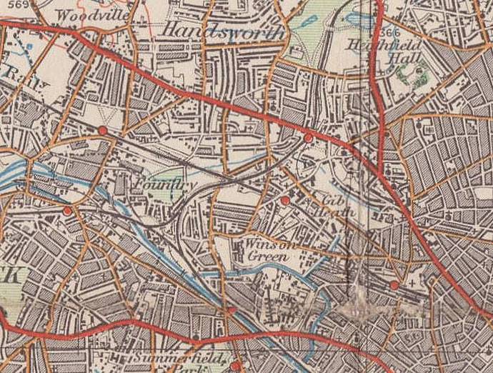
Birmingham Heath, which lay to the north-west of the town, is largely now Winson Green. This was the manor's poor agricultural land and considered to be undeveloped 'waste' until the bulk of it, some 350 hectares, was enclosed by a parliamentary act in 1798.
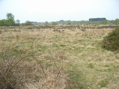
The soil of the Heath is largely made up of glacial drift up to 15 metres in depth overlying sandstone and pebble beds. But the quality of the drift is very variable, with differing mixes of gravel, sand, clay and stones.
There would have been some woodland here, but the heath would have been for the most part large areas of barren heathland. Birmingham Heath was one with Handsworth Heath, which lay to the north-west.
By the 1798 Act the Heath was divided, as was usual, between the local landowners, the largest portion going to Sir Thomas Gooch (See Brookfields). The heath was developed very slowly. The Birmingham Canal attracted a ribbon of industrial development along its banks, and a small number of country mansions were built along the Dudley Road, but extensive housing did not take place until the last quarter of the 19th century.
From the middle of the 19th century the cheap, unattractive and extensive land of the Heath proved a boon to the Birmingham Borough authorities when public institutions were needed for the expanding population of the town. The Borough Gaol opened in 1849, All Saints Hospital the following year and the new Birmingham Workhouse opened in 1852. Various isolation hospitals were opened nearby for serious diseases between 1874 and the end of the century, and in 1889 the Dudley Road Infirmary was built.
See All Saints, Brookfields, Gib Heath and Winson
Green, districts built on Birmingham Heath in the 19th century.
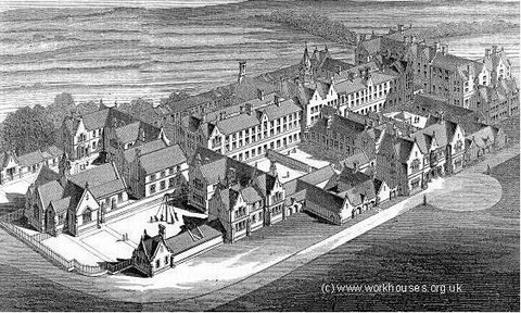
Birmingham Workhouse - bird's-eye view from the south 1852.
Thanks to Peter Higginbotham fior perrmission to reproduce this image.
For a link to his Workhouses website go to Acknowledgements.
William Dargue 12.09.2008/ 30.07.2010
For 19th-century Ordnance Survey maps of Birmingham go to British History Online.
See http://www.british-history.ac.uk/mapsheet.aspx?sheetid=10087&compid=55193.
Map below reproduced from Andrew Rowbottom’s website of Old Ordnance Survey maps Popular Edition, Birmingham 1921. Click the map to link to that website.