Shipton, New Shipton
B76 - Grid reference SP134943
Le Newshippen first record 1433; Shippton 1472; Newshipton 1525
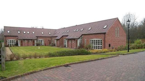
A medieval survival in Walmley is the barn of New Shipton Farm, which is Grade II* Listed and a rare Birmingham cruck-framed building. The barn has five pairs of oak crucks which have been dendrochronologically dated to the spring or summer of 1425.
Le Newshippen first recorded in 1433 as the property of the Lord of the Manor of Sutton Coldfield, Richard Beauchamp, Earl of Warwick. The name suggests that there was an earlier (old) Shipton farm. New Shipton Farm had four 40-acre fields, tenanted by John Verney. The fields lay between Penns Lane and Wylde Green Road. At the beginning of the 18th century the farmhouse, very likely a timber-framed building, was in a dilapidated state but was rebuilt in brick by new owners.
A prestige housing development around the farm began in 2005, as part of which the barn was converted into offices, and the farmhouse and outbuildings into a variety of dwellings.
The name may derive from the Anglo-Saxon, sceap tun, 'sheep farm', or it may have a later medieval date. The keeping of sheep was part of a mixed agricultural economy in this woodland pasture area of the west Midlands, which included keeping cattle as well as the growing of vegetables and cereals.
See also Walmley.
William Dargue 09.03.2009/ 26.07.2015/ 07.01.2011
For 19th-century Ordnance Survey maps of Birmingham go to British History Online.
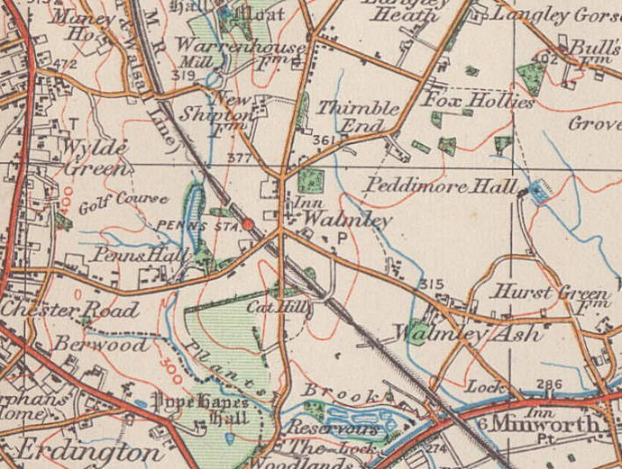
Map below reproduced from Andrew Rowbottom’s website of Old Ordnance Survey maps Popular Edition, Birmingham 1921. Click the map to link to that website.